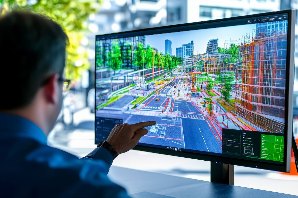
Many planning and infrastructure questions cannot be fully understood from a flat map. Buildings have
height, roads and structures exist at different elevations, utilities may pass above or below one another and
proposed development needs to be considered in relation to its surroundings. 3D GIS provides a way to
represent geographic information in three dimensions. BIM provides detailed information about built
assets. Used together where appropriate, they can give project teams a more complete view of both an
asset and its geographic context
Traditional GIS is highly effective for representing locations, boundaries, networks and relationships across
a geographic area. 3D GIS extends that view by adding height and three dimensional geometry. Buildings,
terrain, infrastructure and other features can be visualized in their spatial context. This can make certain
relationships easier to understand, particularly in dense urban areas and projects where elevation is
important.
BIM, or Building Information Modeling, is commonly used to represent built assets and the information
associated with their components. A BIM model can contain detailed information about elements within a
building or infrastructure project. GIS, on the other hand, is designed to understand geographic location
and relationships across a wider area. The two approaches can complement one another when a project
needs both detailed asset information and broader spatial context.
A building does not exist by itself. It sits on a parcel, connects to roads and utilities and occupies a position
within a larger urban or environmental setting. Infrastructure projects have similar relationships. A 3D
model can become more useful when it can be viewed alongside surrounding geographic information. This
allows project teams to consider the asset and its environment together rather than treating them as
separate datasets
Urban development teams may need to understand how proposed structures relate to existing buildings,
terrain, roads and other infrastructure. A three dimensional spatial environment can make these
relationships easier to communicate during planning discussions. It can also provide a common visual
reference for stakeholders who may not work directly with engineering or GIS software.
Infrastructure often involves assets occupying different horizontal and vertical positions. Pipes, cables,
roads, structures and other components may intersect or pass close to one another. A three dimensional
view can help teams understand these relationships and communicate complex spatial conditions. The
usefulness of the model depends on the accuracy and level of detail of the underlying datasets.
3D GIS is sometimes treated only as a presentation tool, but it can also support analysis when the data is
structured correctly. Depending on the project, teams may need to examine elevation, spatial relationships,
visibility, distances or development scenarios. The important point is to define the question first. A detailed
three dimensional model is useful when it helps answer a real planning or operational question.
Combining GIS and BIM is not simply a matter of placing one model inside another. Different systems may
use different coordinate systems, data structures, geometry representations and levels of detail. A model
can look correct visually while still creating problems for analysis if its spatial reference or attributes are not
handled properly. Integration therefore needs to be planned before large datasets are assembled.
Infrastructure and development information changes. Projects move from design to construction, assets
are modified and surrounding conditions can change. A three dimensional environment should therefore
have a clear approach to updates. Organizations need to understand which data is authoritative, who is
responsible for changes and how new versions are introduced into the wider GIS environment.
Potential applications include urban planning, real estate development, infrastructure projects, utilities,
construction coordination, environmental studies and asset visualization. The appropriate level of detail
varies significantly. A city scale model has different requirements from a detailed building model, and a
planning visualization has different requirements from an operational asset system
Organizations should begin with the decision they want the technology to support. What needs to be
visualized? What needs to be measured? Which users will work with the model? How often will information
change? What existing GIS and BIM data is available? These questions help determine the required data
structure, level of detail and application environment.
3D GIS and BIM can provide complementary views of the built environment. BIM can describe the detailed
components of an asset, while GIS can place that asset within its wider geographic context. When the data
is structured and integrated around a clear use case, the combination can support planning, visualization
and infrastructure coordination more effectively than either dataset viewed in isolation.
If you are exploring 3D GIS, BIM integration or spatial visualization for an infrastructure or
development project, Coderize can help define the data, integration and application approach
around your requirements